The Loneliness of the Guyanas
By FRANK JACOBS
January 16, 2012, 9:22 pm
Source
 The coming weekend might very well be an historic one for Franco-Brazilian relations. Nicolas Sarkozy will be in French Guiana to deliver his annual New Year’s address to France’s overseas territories, in which he is likely to announce the opening of the bridge across the Oyapock River, French Guiana’s border with Brazil.
When the 1,240-ft-long, cable-stayed construction is finally be open for business, it will do more than connect the towns of Saint-Georges-de-l’Oyapock and Oiapoque, on the French and Brazilian banks of the river, respectively. The bridge will establish the first road link between France and Brazil, not to mention the first overland connection between the European Union and the Americas [1].
French Guiana – despite being a French département, the rough equivalent of an American county – is marooned on South America’s northern shore, and suffers accordingly from low name recognition. It is easily confused with Ghana, across the Atlantic, with any of the countries with “Guinea” in their name [2] or any of the other contiguous Guyanas, of which there are two to five, depending on how you define a “Guyana”: to the west of French Guiana is Suriname, which was also called Dutch Guiana before independence in 1975, and to the west of that is British Guiana, which since independence in 1966 has been known simply as Guyana; the areas flanking these three, now parts of Venezuela and Brazil, were sometimes called Spanish Guyana and Portuguese Guyana [3].
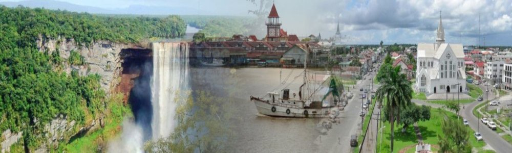
The area’s relative obscurity is not just name-related. With a combined population of less than 1.5 million, the Guyana Three are hardly a hotspot for news. If you know three things about French Guiana, it’s probably these: there’s a pepper (and a Porsche) named after its capital, Cayenne; the notorious French penal colony of Devil’s Island [4] was located off its shore; and it’s the site of the European Space Agency’s spaceport, at Kourou. Suriname? Two things: the Netherlands traded it with the English for New Amsterdam [5], and it’s the only Dutch-speaking country outside of Europe. Guyana? The Jonestown Massacre of 1978.
But as a set, the three entities are a significant anomaly, and a case study in the way that geology and the environment can combine with geopolitics to shape a region’s history.
Since Belize won independence in 1981, French Guiana is the last territory on the American mainland controlled by a non-American power. But in fact, all three Guyanas are Fremdkörper in Latin America: they are the only territories in the region without either Spanish or Portuguese as a national language. These are coastal countries, culturally closer to the Caribbean.
Moreover, these shores are cut off from the rest of the subcontinent by dense rainforest. And that jungle remains virgin by virtue of the Guyana Shield, a collection of mountain ranges and highlands seemingly designed to conserve the interior’s impenetrability [6]. The shield is best known for its tepuis: enormous mesas that rise dramatically from the jungle canopy and are often home to unique flora and fauna (tepuis feature prominently in Arthur Conan Doyle’s “The Lost World” and, more recently, the animated film “Up.”)
But the ultimate scapegoat for the loneliness of the Guyanas is Pope Alexander VI. It was he who decreed the Papal Line of Demarcation in 1493, dividing the new world between the Spanish and the Portuguese. The line ran halfway between the Portuguese-held Cape Verde Islands and the new Spanish possessions of Cuba and Hispaniola. This border was meant to put an end to the bickering between the two Iberian powers, giving Spain rights to all lands west of the line and Portugal to anything east of it. Divide and conquer, indeed [7].
 The papal border thus awarded only the tip of the Brazilian bulge to Portugal. A final agreement, at the Treaty of Tordesillas of 1494, placed the line somewhat further west, at around 46 degrees west longitude. But although arguments about the true course of the Tordesillas line persisted [8], it soon became irrelevant. Portugal extended its domain deep into the core of the continent; Brazil’s westernmost point is only 375 miles from the Pacific Ocean. The fantastically named town of Marechal Thaumaturgo [9], in Acre, Brazil’s westernmost state, is further west than Santiago, the capital of Chile.
But even if the papally endorsed meridian proved ineffective at holding back the Portuguese, the invisible spell over the vast Amazonian jungle did have one clear result: It helped keep away the Spanish, who concentrated on the far side of the continent, conquering the rich empires of Mexico and Peru.
Vatican edicts do not work on Protestants, however, and the Dutch and English felt unconstrained by the decision to divvy up the subcontinent between Spain and Portugal. In the early 17th century, Protestant plantations sprang up in the fertile Guyanan coastlands. Ironically, the Dutch pioneered settlement in what is now Guyana, while the English were the first to colonize Suriname. France settled what was left, and the three powers proceeded to fight over and swap their Guyanas like they did with their Caribbean islands.
All the colonizing, planting and fighting was done on the coast; the forested inlands were left to tribes, both of native Indians and of runaway African slaves, known locally as maroons. When borders were needed, rivers were the easy choice: obvious demarcations that conveniently disappeared in the impenetrable jungle. If you follow the coastal route from the Brazilian state of Amapá [10] to Venezuela, you’ll first cross the Oiapoque River into French Guyana, then the Maroni into Suriname, and then the Corentyne into Guyana. That country’s coastal border with Venezuela is atypically not a river — even though Venezuela would really, really like it to be.
The Guyana-Venezuela border largely follows the so-called Schomburgk Line, so called after the German-born British naturalist and explorer who sketched it in 1840, tracing what he presumed to be the western border claim of the old Dutch colony of Essequibo [11]. The Venezuelan authorities, however, have long maintained that the Essequibo River, not the Schomburgk Line, is their natural eastern border. This is no small matter: the area in between the line and the river is 61,500 square miles, or 62 percent of Guyana’s territory. The territory is referred to as Guayana Esequiba on Venezuelan maps, which show it as part of the country, although generally labeled as Zona en reclamación (“Area claimed [by Venezuela]”) by everyone else.
To make matters worse, Robert Hermann Schomburgk, perhaps like those pliable court geographers of yore, had included the mouth of the Orinoco River on the British side of his line, which would have enabled Britain to levy a toll on ships sailing up the Orinoco. That was an act of cartographic aggression the Venezuelans could not tolerate.
The dispute really got going late in the 19th century. Invoking the Monroe Doctrine, Venezuela won American backing for international arbitration. But in 1899 a tribunal, composed of two American, two British and two Russian judges, ruled largely in favor of the British. London had to give up the Orinoco delta, but perhaps as a lingering phantom of that larger claim, the coastal border between Guyana and Venezuela today runs in a straight, northwest-southeast line next to the beach, producing a strange pene-enclave [12] a dozen miles long and 300 feet wide at its narrowest. At the southern end of this strange strip, where the line crosses the Rio Barima, lies the aptly named town of La Linea.
Half a century later, the conflict surged again: in 1949, a posthumously released document of an eyewitness to the tribunal alleged that its result was fixed in favor of the British. According to the statement, the Russian chairman of the panel had pressured the American judges to accept a unanimous award of the Schomburgk Line, minus the Orinoco and a few other gains for Venezuela, or else be faced with a majority decision even more favorable to Britain. Based on this evidence, Venezuela resurrected its claims, which it maintains to this day.
It must be a pretty claustrophobic experience being a map nerd in Guyana. For not only is your western neighbor claiming most of your country, the country on the other side is also doing its best to nibble away at your territory: Suriname claims the so-called New River Triangle [13] in the southern part of both countries’ common border.
Here the matter should be seemingly easier to settle. Both sides agreed that the Corentyne River was the boundary between Guyana and Suriname. But the question remained of its exact course inland, through the dense and largely unexplored interior. Schomburgk — him again — followed the river to its source to establish the border. But in 1871, Charles Barrington Brown resurveyed the area and found that the so-called New River was the actual source of the Lower Corentyne. (In Suriname, the New River is called the Boven-Corantijn, or “Upper Corentyne.”) The result is a triangular patch of territory between the two rivers and the Brazilian border: the New River Triangle.
Unlike the Venezuelan claim, which has remained dormant, violence has flared up occasionally around the Guyana-administered New River Triangle. In 1969, border skirmishes raised the specter of all-out war, though in 1971 both sides agreed to demilitarize the area. In 2000, a dispute over the sea border between both countries got nasty when Suriname forcibly ejected personnel from Guyanese oil rigs in the area. A United Nations tribunal has since provided a new border, accepted by both sides.
The New River Triangle dispute has an eerie twin on the eastern border of Suriname, where it contests the border with French Guiana. Again, river sources are the issue.
The Maroni (“Marowijne” in Dutch) River was long the accepted border near the coast, and nobody really minded what went on upstream. Then, in 1861, a Franco-Dutch commission ruled that the Lawa River was the source for the Maroni, and not the Tapanahoni further west. For a while, no one cared, because the European powers didn’t see a value in the interior. All that went out the window in the 1880s, when gold was discovered in the area. France wanted a large chunk of the area between the Lawa and the Tapanahoni, shifting the border west. But an independent arbiter – Tsar Alexander III of Russia [14] – confirmed the Lawa as the international border.
Once this was firmly established, the same problem reappeared further upstream. Which is the true source of the Lawa? The Litani or the Marowini? The question has yet to be answered to both sides’ satisfaction, leaving another slice of inland Guyana in legal limbo. No prizes for who guesses which side actually runs the show in the area, though. Just one tip: It’s the side with the nuclear missiles and the Security Council veto.
But even French Guiana has not always been secure in its borders. Its eastern edge, the one Mr. Sarkozy may be visiting to open that bridge, was once the scene of a territorial dispute. In 1886, a handful of French adventurers founded the République de Counani in the area now occupied by the Brazilian state of Amapà. The phantom nation, which wasn’t even recognized by France, was “administered” from Paris by Jules Gros, originally a journalist, but now president-for-life of the fledgling state. Brazil, needless to say, wasn’t pleased. After Swiss arbitration, Brazil annexed the territory in 1895.
In short, if Mr. Sarkozy officially opens the Oyapoque bridge next week, he will do more than just inaugurate an obscure jungle passage: he will help end centuries of Guyanan isolation and conflict, underscored by its riverine borders and inaugurate the area’s long-overdue integration with the rest of South America. Maybe one day – if other bridges get built – there will be a coastal highway connecting five of the region’s capitals: Macapà (Amapà), Cayenne (French Guiana), Paramaribo (Suriname), Georgetown (Guyana) and Caràcas (Venezuela). Given the right rhetoric flourish, his speech may later be remembered as the beginning of it all.
Frank Jacobs is a London-based author and blogger. He writes about cartography, but only the interesting bits.
[1] Plans for the bridge over the Oyapock River (Oiapoque in Portuguese) were unveiled in 1997. Finished in November 2011, the bridge’s inauguration has been delayed — probably pending Mr. Sarkozy’s overseas address, slated for Jan. 22. By the way, a bridge between mainland France and Brazil would have to be 4,100 miles long, in a straight line across the Atlantic to Brittany.
[2] Namely, Guinea, Guinea-Bissau and Equatorial Guinea, all in Africa, and Papua New Guinea, in Oceania. Contributing to the confusion is the fact that guinea pigs are not natives of Africa, but of South America (though not Guyana).
[3] The historical spelling “Guiana” is maintained when referring to the French territory, but was changed to “Guyana” by the independent republic of that name. The modern spelling is preferred when referring to the present-day area.
[4] Devil’s Island operated from 1850 to 1952. Its most famous inmate was Alfred Dreyfus, the French army captain unjustly convicted for treason. It is also the setting of the Steve McQueen/Dustin Hoffman film “Papillon.”
[5] Now New York City. The exchange was made as part of the Treaty of Breda in 1667, which ended the Second Anglo-Dutch War.
[6] A purpose defeated by the Salto Ángel, or Angel Falls, in Venezuela. At over 2,600 feet, it is the world’s highest waterfall, and a major tourist attraction.
[7] The necessary pendant to the Tordesillas line was an “antimeridian” on the other side of the globe, agreed upon at the Treaty of Zaragoza in 1529, running at 142 degrees east longitude.
[8] Estimates varied anywhere from 22 degrees west longitude to 50 degrees west longitude, not only through the pliable loyalties of court geographers, but also because of gross inaccuracies in estimates of the earth’s size.
[9] “Marshall Miracle Worker.”
[10] Formerly also known as Braziian Guyana, Amapá itself is only reachable from the rest of Brazil by crossing the Jari or Amazon rivers.
[11] Essequibo, Demerara and Berbice were Dutch colonies until 1814, when they were ceded to Britain. In 1831, they were merged to become British Guiana.
[12] Almost an enclave, like a peninsula is almost an island.
[13] Suriname calls this the Tigri-gebied (“Tigri Area”).
[14] Why so many Russians on boundary tribunals? Were they perhaps considered disinterested and thus impartial?
By FRANK JACOBS
January 16, 2012, 9:22 pm
Source
The coming weekend might very well be an historic one for Franco-Brazilian relations. Nicolas Sarkozy will be in French Guiana to deliver his annual New Year’s address to France’s overseas territories, in which he is likely to announce the opening of the bridge across the Oyapock River, French Guiana’s border with Brazil.When the 1,240-ft-long, cable-stayed construction is finally be open for business, it will do more than connect the towns of Saint-Georges-de-l’Oyapock and Oiapoque, on the French and Brazilian banks of the river, respectively. The bridge will establish the first road link between France and Brazil, not to mention the first overland connection between the European Union and the Americas [1].
French Guiana – despite being a French département, the rough equivalent of an American county – is marooned on South America’s northern shore, and suffers accordingly from low name recognition. It is easily confused with Ghana, across the Atlantic, with any of the countries with “Guinea” in their name [2] or any of the other contiguous Guyanas, of which there are two to five, depending on how you define a “Guyana”: to the west of French Guiana is Suriname, which was also called Dutch Guiana before independence in 1975, and to the west of that is British Guiana, which since independence in 1966 has been known simply as Guyana; the areas flanking these three, now parts of Venezuela and Brazil, were sometimes called Spanish Guyana and Portuguese Guyana [3].
The area’s relative obscurity is not just name-related. With a combined population of less than 1.5 million, the Guyana Three are hardly a hotspot for news. If you know three things about French Guiana, it’s probably these: there’s a pepper (and a Porsche) named after its capital, Cayenne; the notorious French penal colony of Devil’s Island [4] was located off its shore; and it’s the site of the European Space Agency’s spaceport, at Kourou. Suriname? Two things: the Netherlands traded it with the English for New Amsterdam [5], and it’s the only Dutch-speaking country outside of Europe. Guyana? The Jonestown Massacre of 1978.
But as a set, the three entities are a significant anomaly, and a case study in the way that geology and the environment can combine with geopolitics to shape a region’s history.
Since Belize won independence in 1981, French Guiana is the last territory on the American mainland controlled by a non-American power. But in fact, all three Guyanas are Fremdkörper in Latin America: they are the only territories in the region without either Spanish or Portuguese as a national language. These are coastal countries, culturally closer to the Caribbean.
Moreover, these shores are cut off from the rest of the subcontinent by dense rainforest. And that jungle remains virgin by virtue of the Guyana Shield, a collection of mountain ranges and highlands seemingly designed to conserve the interior’s impenetrability [6]. The shield is best known for its tepuis: enormous mesas that rise dramatically from the jungle canopy and are often home to unique flora and fauna (tepuis feature prominently in Arthur Conan Doyle’s “The Lost World” and, more recently, the animated film “Up.”)
But the ultimate scapegoat for the loneliness of the Guyanas is Pope Alexander VI. It was he who decreed the Papal Line of Demarcation in 1493, dividing the new world between the Spanish and the Portuguese. The line ran halfway between the Portuguese-held Cape Verde Islands and the new Spanish possessions of Cuba and Hispaniola. This border was meant to put an end to the bickering between the two Iberian powers, giving Spain rights to all lands west of the line and Portugal to anything east of it. Divide and conquer, indeed [7].
The papal border thus awarded only the tip of the Brazilian bulge to Portugal. A final agreement, at the Treaty of Tordesillas of 1494, placed the line somewhat further west, at around 46 degrees west longitude. But although arguments about the true course of the Tordesillas line persisted [8], it soon became irrelevant. Portugal extended its domain deep into the core of the continent; Brazil’s westernmost point is only 375 miles from the Pacific Ocean. The fantastically named town of Marechal Thaumaturgo [9], in Acre, Brazil’s westernmost state, is further west than Santiago, the capital of Chile.But even if the papally endorsed meridian proved ineffective at holding back the Portuguese, the invisible spell over the vast Amazonian jungle did have one clear result: It helped keep away the Spanish, who concentrated on the far side of the continent, conquering the rich empires of Mexico and Peru.
Vatican edicts do not work on Protestants, however, and the Dutch and English felt unconstrained by the decision to divvy up the subcontinent between Spain and Portugal. In the early 17th century, Protestant plantations sprang up in the fertile Guyanan coastlands. Ironically, the Dutch pioneered settlement in what is now Guyana, while the English were the first to colonize Suriname. France settled what was left, and the three powers proceeded to fight over and swap their Guyanas like they did with their Caribbean islands.
All the colonizing, planting and fighting was done on the coast; the forested inlands were left to tribes, both of native Indians and of runaway African slaves, known locally as maroons. When borders were needed, rivers were the easy choice: obvious demarcations that conveniently disappeared in the impenetrable jungle. If you follow the coastal route from the Brazilian state of Amapá [10] to Venezuela, you’ll first cross the Oiapoque River into French Guyana, then the Maroni into Suriname, and then the Corentyne into Guyana. That country’s coastal border with Venezuela is atypically not a river — even though Venezuela would really, really like it to be.
The Guyana-Venezuela border largely follows the so-called Schomburgk Line, so called after the German-born British naturalist and explorer who sketched it in 1840, tracing what he presumed to be the western border claim of the old Dutch colony of Essequibo [11]. The Venezuelan authorities, however, have long maintained that the Essequibo River, not the Schomburgk Line, is their natural eastern border. This is no small matter: the area in between the line and the river is 61,500 square miles, or 62 percent of Guyana’s territory. The territory is referred to as Guayana Esequiba on Venezuelan maps, which show it as part of the country, although generally labeled as Zona en reclamación (“Area claimed [by Venezuela]”) by everyone else.
To make matters worse, Robert Hermann Schomburgk, perhaps like those pliable court geographers of yore, had included the mouth of the Orinoco River on the British side of his line, which would have enabled Britain to levy a toll on ships sailing up the Orinoco. That was an act of cartographic aggression the Venezuelans could not tolerate.
The dispute really got going late in the 19th century. Invoking the Monroe Doctrine, Venezuela won American backing for international arbitration. But in 1899 a tribunal, composed of two American, two British and two Russian judges, ruled largely in favor of the British. London had to give up the Orinoco delta, but perhaps as a lingering phantom of that larger claim, the coastal border between Guyana and Venezuela today runs in a straight, northwest-southeast line next to the beach, producing a strange pene-enclave [12] a dozen miles long and 300 feet wide at its narrowest. At the southern end of this strange strip, where the line crosses the Rio Barima, lies the aptly named town of La Linea.
Half a century later, the conflict surged again: in 1949, a posthumously released document of an eyewitness to the tribunal alleged that its result was fixed in favor of the British. According to the statement, the Russian chairman of the panel had pressured the American judges to accept a unanimous award of the Schomburgk Line, minus the Orinoco and a few other gains for Venezuela, or else be faced with a majority decision even more favorable to Britain. Based on this evidence, Venezuela resurrected its claims, which it maintains to this day.
It must be a pretty claustrophobic experience being a map nerd in Guyana. For not only is your western neighbor claiming most of your country, the country on the other side is also doing its best to nibble away at your territory: Suriname claims the so-called New River Triangle [13] in the southern part of both countries’ common border.
Here the matter should be seemingly easier to settle. Both sides agreed that the Corentyne River was the boundary between Guyana and Suriname. But the question remained of its exact course inland, through the dense and largely unexplored interior. Schomburgk — him again — followed the river to its source to establish the border. But in 1871, Charles Barrington Brown resurveyed the area and found that the so-called New River was the actual source of the Lower Corentyne. (In Suriname, the New River is called the Boven-Corantijn, or “Upper Corentyne.”) The result is a triangular patch of territory between the two rivers and the Brazilian border: the New River Triangle.
Unlike the Venezuelan claim, which has remained dormant, violence has flared up occasionally around the Guyana-administered New River Triangle. In 1969, border skirmishes raised the specter of all-out war, though in 1971 both sides agreed to demilitarize the area. In 2000, a dispute over the sea border between both countries got nasty when Suriname forcibly ejected personnel from Guyanese oil rigs in the area. A United Nations tribunal has since provided a new border, accepted by both sides.
The New River Triangle dispute has an eerie twin on the eastern border of Suriname, where it contests the border with French Guiana. Again, river sources are the issue.
The Maroni (“Marowijne” in Dutch) River was long the accepted border near the coast, and nobody really minded what went on upstream. Then, in 1861, a Franco-Dutch commission ruled that the Lawa River was the source for the Maroni, and not the Tapanahoni further west. For a while, no one cared, because the European powers didn’t see a value in the interior. All that went out the window in the 1880s, when gold was discovered in the area. France wanted a large chunk of the area between the Lawa and the Tapanahoni, shifting the border west. But an independent arbiter – Tsar Alexander III of Russia [14] – confirmed the Lawa as the international border.
Once this was firmly established, the same problem reappeared further upstream. Which is the true source of the Lawa? The Litani or the Marowini? The question has yet to be answered to both sides’ satisfaction, leaving another slice of inland Guyana in legal limbo. No prizes for who guesses which side actually runs the show in the area, though. Just one tip: It’s the side with the nuclear missiles and the Security Council veto.
But even French Guiana has not always been secure in its borders. Its eastern edge, the one Mr. Sarkozy may be visiting to open that bridge, was once the scene of a territorial dispute. In 1886, a handful of French adventurers founded the République de Counani in the area now occupied by the Brazilian state of Amapà. The phantom nation, which wasn’t even recognized by France, was “administered” from Paris by Jules Gros, originally a journalist, but now president-for-life of the fledgling state. Brazil, needless to say, wasn’t pleased. After Swiss arbitration, Brazil annexed the territory in 1895.
In short, if Mr. Sarkozy officially opens the Oyapoque bridge next week, he will do more than just inaugurate an obscure jungle passage: he will help end centuries of Guyanan isolation and conflict, underscored by its riverine borders and inaugurate the area’s long-overdue integration with the rest of South America. Maybe one day – if other bridges get built – there will be a coastal highway connecting five of the region’s capitals: Macapà (Amapà), Cayenne (French Guiana), Paramaribo (Suriname), Georgetown (Guyana) and Caràcas (Venezuela). Given the right rhetoric flourish, his speech may later be remembered as the beginning of it all.
Frank Jacobs is a London-based author and blogger. He writes about cartography, but only the interesting bits.
[1] Plans for the bridge over the Oyapock River (Oiapoque in Portuguese) were unveiled in 1997. Finished in November 2011, the bridge’s inauguration has been delayed — probably pending Mr. Sarkozy’s overseas address, slated for Jan. 22. By the way, a bridge between mainland France and Brazil would have to be 4,100 miles long, in a straight line across the Atlantic to Brittany.
[2] Namely, Guinea, Guinea-Bissau and Equatorial Guinea, all in Africa, and Papua New Guinea, in Oceania. Contributing to the confusion is the fact that guinea pigs are not natives of Africa, but of South America (though not Guyana).
[3] The historical spelling “Guiana” is maintained when referring to the French territory, but was changed to “Guyana” by the independent republic of that name. The modern spelling is preferred when referring to the present-day area.
[4] Devil’s Island operated from 1850 to 1952. Its most famous inmate was Alfred Dreyfus, the French army captain unjustly convicted for treason. It is also the setting of the Steve McQueen/Dustin Hoffman film “Papillon.”
[5] Now New York City. The exchange was made as part of the Treaty of Breda in 1667, which ended the Second Anglo-Dutch War.
[6] A purpose defeated by the Salto Ángel, or Angel Falls, in Venezuela. At over 2,600 feet, it is the world’s highest waterfall, and a major tourist attraction.
[7] The necessary pendant to the Tordesillas line was an “antimeridian” on the other side of the globe, agreed upon at the Treaty of Zaragoza in 1529, running at 142 degrees east longitude.
[8] Estimates varied anywhere from 22 degrees west longitude to 50 degrees west longitude, not only through the pliable loyalties of court geographers, but also because of gross inaccuracies in estimates of the earth’s size.
[9] “Marshall Miracle Worker.”
[10] Formerly also known as Braziian Guyana, Amapá itself is only reachable from the rest of Brazil by crossing the Jari or Amazon rivers.
[11] Essequibo, Demerara and Berbice were Dutch colonies until 1814, when they were ceded to Britain. In 1831, they were merged to become British Guiana.
[12] Almost an enclave, like a peninsula is almost an island.
[13] Suriname calls this the Tigri-gebied (“Tigri Area”).
[14] Why so many Russians on boundary tribunals? Were they perhaps considered disinterested and thus impartial?