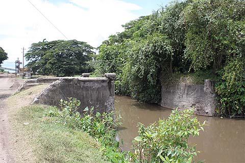
Here's another head-scratcher. Look at this photo and guess the locality and purpose of those concrete abutments.
Old bridge way for the railroad?
I would guess somewhere going to Parika
PIC look like Uitvlugt estate rd where the train line used to be.
Absolutely positively correct, Django.
The WCD railway line spanned that bridge. To the left, across the road, was Samlall's cake shop and the railway station. Just after the right concrete abutment, where that bush is, was a big bond that stored sugar that were loaded on barges that transported it to Georgetown. Fire caused by a cigarette butt destroyed that bond in 1958.
Now, the personal part. I learned to swim in that canal in that same spot just before the railway bridge, now marked by those small plants in the foreground. The year was 1964. When I left Guyana in 1996, alligators infested that stretch of the canal. The Uitvlugt Estate management had recruited the alligators to prevent people from accessing sugar cane in the fields on the right bank of the canal.
One more thing: there was a bump on the road at the railway crossing. The road is level now but part of the bump is still seen on the left abutment in picture.
How come you move around so much in GY, me think you were a GT bai.
I lived most ah me life at Albion and visited other places occasionally.
Catherina was me favourite place on de WC.
What get me Gil, like you, we swim in the trench at Albion and if something smooth rub against we leg, we splash the wata and continue swimming.
Years later me go back and see alligators and big snakes sunning on the bank.
Whea rass dem been when we swimming and we nevva lost a kid.

